Rare Maps Collection
By Special Collections
Special Collection’s Rare Maps Collection is divided into four categories:
- World – Maps of the world, and of areas of the eastern hemisphere: Africa, Europe, Asia, Australia, and Antarctica.
- New World – Maps of the western hemisphere: North and South America, including Central America and the West Indies.
- U.S. and the Americas – Maps of North America after 1776.
- Alabama – Maps of Alabama and the surrounding area, including as part of Georgia Territory and Mississippi Territory.
A list is presented below, with call number and, in the case of the World Maps, a description of its scope. To view any of these maps, request them by title and call number via the Aeon requesting system.
Special Collections has hundreds more maps, especially of Alabama and the southeast U.S. Like these rare maps, they can be found in a search of the library catalog and viewed in the reading room upon request.
Many of these and other rare maps can be found online in our Digital Collections, in Historical Maps. Titles linked below go to those digitized items.
World
Overview
Though attempts at a world map date back to ancient Greece and Rome and maps of the world as it was known appear throughout the middle ages, the first maps that look like the world as we know it appear in the 16th century. They came from a school of Dutch and Flemish cartographers working in Leuven, Antwerp, and Amsterdam, then all part of the Netherlands. Those for which we have examples include the following:
- Gerardus Mercator (1512-1594)
- Abraham Ortelius (1527-1598)
- Jodocus Hondius (1563-1612)
- Willem Janszoon Blaeu (1571-1638)
- Peter Kaerius (1571-1646)
- Isaac Abrahamszoon Massa (1586-1643)
- Claes Janszoon Visscher (1587-1652)
- Johannes Janssonius (1588-1664)
- Hendrik Hondius (1573-1650)
- Joan Blaeu (1596-1673)
- Frederik de Wit (1629/30-1760)
European mapmaking was not, however, confined to the Dutch. French cartographers in our collection include Sébastien Pontault de Beaulieu (1612-1674), Guillaume Delisle (1675-1726), and Jean Baptiste Bourguignon d’Anville (1697-1782). Other prominent cartographers represented here are Llwyd Humphrey (1527-1568) of Wales, Johannes Michael Gigas (1582-1637) of the Holy Roman Empire (German), Vincenzo Coronelli (1650-1718) of Venice (Italian), Herman Moll (1654-1732) in England (Dutch), Timothy Pont (1565-1614) of Scotland, and John Senex (1678-1740) of England.
List
Presented chronologically by region.
World
Ortelius, Abraham, and Frans Hogenberg (engraver). Typvs orbis terrarvm. 1570.
- Description: Map of the world
- Note: It depicts the imagined continent Terra Australis Incognita (“unknown southern land”), while the island eventually known as Australia was yet to be charted
- Call Number: G3200 1570z .O77x
Blaeu, Willem Janszoon. Nova totius terrarum orbis geographica ac hydrographica tabula. 1635.
- Description: Map of the world
- Note: It depicts the imagined continent Terra Australis Incognita (“unknown southern land”), while the island eventually known as Australia was yet to be charted
- Call Number: G3200 1635 .B53x
Senex, John (engraver). A new map of the world from the latest observations. 1721.
- Description: Map of the world
- Call Number: G3200 1721 .S46x
Laurie, Robert, and James Whittle. A new map of the world with Captain Cook’s tracks, his discoveries and those of the other circumnavigators. 1794.
- Description: Map of the world
- Note: The hemispheres are presented as separate globes, in a Nicolosi globular projection
- Call Number: G3200 1794 .R6x
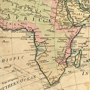
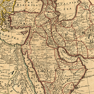
Africa & Middle East
Mercator, Gerardus. Africa: ex magna Orbis terre descriptione Gerardi Mercatoris desumpta, studio & industria G.M. Iunioris. 1587.
- Description: Map of Africa and the Arabian Peninsula, with portions of the southern Mediterranean region
- Call Number: G8200 1587 .M47x
Hondius, Henrick. Africae nova tabula. 1631.
- Description: Map of Africa, with portions of the Mediterranean region and Arabian peninsula
- Call Number: G8200 1631 .H66x
Senex, John, and Guillaume Delisle. A map of Turkey, Arabia and Persia: corrected from the latest travels and from the observations of the Royal Societys of London and Paris. 1714.
- Description: Map of the Middle East, with northeastern Africa and southern Europe
- Note: The territory shown is bounded by the German states and Poland in the north, modern Pakistan in the east, Abyssinia (modern Ethiopia) in the south, and Algeria and Spain in the west
- Call Number: G7420 1714 .S4x
Senex, John. A new map of Africa: from the latest observations. 1721.
- Description: Map of Africa and the Arabian Peninsula, with portions of the southern Mediterranean region
- Note: Modern Iran, then Safavid dynasty Persia, is shown in outline only
- Call Number: G8200 1721 .S4x
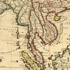
Asia & Middle East
Mercator, Gerardus. Iaponia. 1594.
- Description: Map of Japan, with Korea (as an island) and the coast of China
- Call Number: G7960 1594 .M47x
Hondius, Hendrik, and Gerardus Mercator. Asia recens summa cura delineata. 1631.
- Description: Map of Asia and the Middle East, with portions of eastern Africa and southeastern Europe
- Call Number: G7400 1631 .H65x
Senex, John. A new map of Asia: from the latest observations. 1721.
- Description: Map of Asia and the Middle East, including the Arctic region (inset), with portions of Europe and Africa largely in outline
- Note: A portion of Australia (New Holland) appears at the bottom right, and the imagined island Iesso appears north of Japan
- Call Number: G7400 1721 .S4x
Senex, John. A new map of India & China: from the latest observations. 1721.
- Description: Map of Asia, including South Asia, East Asia, Southeast Asia, and part of Central Asia
- Note: The territory is bounded by modern Samarkand, Uzbekistan, in the northwest, Japan in the northeast, New Guinea in the southeast, and the Indian subcontinent and the Maldives in the southeast.
- Call Number: G7650 1721 .S4x
Europe
See subheadings for regions of Europe: Northern, British Isles, Western, Central, Southern, and Eastern.
Hondius, Jodocus. Nova Europae descriptio. 1595.
- Description: Map of Europe, as far east as the Caspian Sea, with portions of northern Africa and Asia Minor
- Call Number: G5700 1595 .H6x
Europa. 1663.
- Description: Map of Europe, as far east as the Caspian Sea, with portions of northern Africa and Asia Minor
- Call Number: G5701 .S1 1663 .M4x
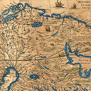
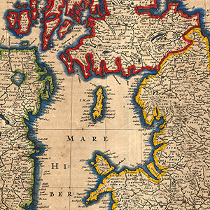
Northern
Ortelius, Abraham. Septentrionalivm regionvm descrip. 1570.
- Description: Map of northern Europe, including Fenno-Scandinavia, the British Isles, Iceland, and Greenland
- Call Number: G6910 1570 .O7x
Jansoon, Jan. Nova et accurata Tabula Episcopatvvm Stavangriensis, Bergensis et Asloriensis vicinarumque aliquot territoriorum. 1658.
- Description: Map of Norway, then part of Denmark-Norway; map shows territory as far north as Sognefjorden and as far east as the coast of Sweden, although the map is relatively blank east of Oslo, Norway
- Call Number: G6940 1658 .J36x
Hondius, Hendrik. Sveciae, Norvegiae, et Daniae, nova tabula. 1600s.
- Description: Map of Fenno-Scandinavia and the Baltic region, covering all of modern Norway, Denmark, Sweden, Finland, Estonia, Latvia, Lithuania, Belarus, and Russia, with portions of central Europe
- Call Number: G6910 1600z .H6x
Hondius, Hendrik. Poli Arctici, et circumiacentum terrarum descriptio novissima. 1600s.
- Description: Map of the arctic (north polar region), as far as it was known, including far northern Eurasia, Greenland, and Iceland
- Call Number: G9780 1600z .H65x
Flandrus, Georgius Carolus. Tabvla Islandiae. 1658.
- Description: Map of Iceland
- Call Number: G6930 1658 .F54x
Senex, John. Scandinavia and its confines in which are the Kindgom’s of Sweden, Norway, &c.: divided into their principall provinces. 1719.
- Description: Map of the Fennoscandian Peninsula, then divided between Norway, Sweden (including modern Finland), and Russia, with portions of central and eastern Europe
- Call Number: G6910 1719 .S4x
Senex, John, and Herman Moll (engraver). A new map of the Kingdom of Denmark with the Dutchy of Holstein, etc.: according to the newest observations. 1721.
- Description: Map of Denmark (Jutland) and the Duchy of Holstein, in modern Denmark and Germany, with portions of modern northern Germany and southern Sweden.
- Call Number: G6920 1721 .S4x
British Isles
Llwyd, Humphrey, and Pieter van den Keere (engraver). Cambriae typus. 1573.
- Description: Map of Wales
- Call Number: G5760 1573 .L5x
Pont, Timothy. A new description of the shyres Lothian and Linlitqvo. 1600s.
- Description: Map of the Lothian region of southeastern Scotland
- Call Number: G5770 1600z .P66x
Mercator, Gerardus. Anglia, Scotia et Hibernia. 1628.
- Description: Map of England, Scotland, and Ireland, with portions of France, the Netherlands (including modern Belgium), and Norway
- Call Number: G5740 1628 .M4x
Mercator, Gerardus. Anglesey; Wight Vectis olim; Garnesay; Iarsay. 1633.
- Description: Maps of four British islands: Anglesey in the Irish Sea, and Guernsey and Jersey (Channel Islands) and the Isle of Wight in the English Channel
- Call Number: G5752 .A6 1633 .M4x
Mercator, Gerardus. Warwicum, Northamtonia, Huntingdonia, Cantabrigia, Suffolcia, Oxonium, Buckinghamia, Bedfordia, Hartfordia, Essexia, Berceria, Middlesexia, Southátonia, Surria, Cantiá & Southsexia. 1633.
- Description: Map of the southeast regions of England: Warwick, Northampton, Huntingdon, Cambridge, Suffolk, Oxford, Buckinghamshire, Bedfordshire, Hartfordshire, Essex, Berkshire, Middlesex, Southampton, Surrey, Kent, and Sussex
- Call Number: G5752 .W3 1633 .M4x
Mercator, Gerardus. Eboracvm, Lincolnia, Derbia, Staffordia, Nottinghamia, Lecestria, Rotlandia et Norfolcia. 1633.
- Description: Map of the east central regions of England: York, Lincoln, Derby, Staffordshire, Nottinghamshire, Leicestershire, Rutland, and Norfolk
- Call Number: G5752 .E2 1633 .M4x
Mercator, Gerardus. Northumbria, Cumberlandia, et Dunelmensis Episcopatus. 1633.
- Description: Map of the northern regions of England: Northumbria, Cumbria, and County Durham, with a portion of Scotland
- Call Number: G5752.N6 1633 .M4x
Mercator, Gerardus. [La seconde table d’Escosse] 1633.
- Description: Map of Scotland, with a portion of northern England
- Note: It does not depict the extreme north, including the Outer Hebrides
- Call Number: G5771 .S4 1633 .M4x
Jansoon, Jan, and Abraham Ortelius. Insvlarvm Britannicarvm. 1640.
- Description: Map of England, Scotland, and Ireland
- Note: It orients with north on the right
- Call Number: G5740 1640 .J35x
Jansson, Jan. Anglia regnvm. 1640.
- Description: Map of England, with portions of Scotland and Ireland in outline
- Call Number: G5750 1640 .J35x
Jansson, Jan. Hibernia regnvm vulgo Ireland. 1650s.
- Description: Map of Ireland
- Call Number: G5780 1650z .J35x
Jansson, Jan. Magnae Britanniae et Hiberniae, nova descriptio. 1658.
- Description: Map of England, Scotland, and Ireland
- Call Number: G5740 1658 .M3x
Hondius, Hendrik. Orcadvm et Schetlandiae Insularvm accuratissima descriptio. 1658.
- Description: Map of the Northern Isles of Scotland: the Orkney and Shetland Islands
- Call Number: G5772 .O6 1658 .H6x
Senex, John (engraver). A new map of England: from the latest observations. 1721.
- Description: Map of England, with portions of Scotland and Ireland in outline
- Call Number: G5750 1721 .S4x
Senex, John (engraver). A new map of Scotland. 1721.
- Description: Map of Scotland, including the Inner and Outer Hebrides, the Orkney Islands, and the Isle of Shetland (inset), with a portion of northern England
- Call Number: G5770 1721 .S4x
Western
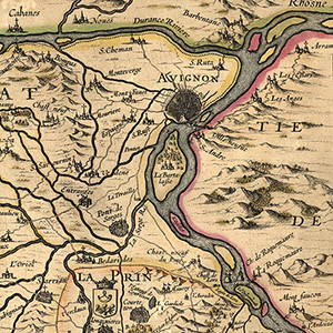
La principavté d’Orange et Comtat de Venaissin. 1627.
- Description: Map of the Principality of Orange, a vassal kingdom of the Holy Roman Empire, and Comtat Venaissin, part of the Papal States, both in modern France
- Note: It is oriented with north at the bottom
- Call Number: G5833 .V3 1627 .P7x
Hondius, Hendrik. La Sovveraineté de Sedan: et de Ravcovrt, et la Prevosté de Doncheri. 1600s.
- Description: Map of the Principality of Sedan and Raucourt and the Prevost of Donchery, now in the northeast of modern France, with portions of the Picardy, Champagne, and Lorraine regions of modern France, as well as modern Luxembourg and Belgium
- Call Number: G5833 .A55 1600z .H6x
Beaulieu, Sebastien de Pontault. Plan de l’Isle de la Conference: ou le Traite de le Paix General, entre la France et l’Espagne a esté conclu [.] au mois de Novembre 1659. 1659.
- Description: Map of the area around Pheasant Island, located in the River Bidasoa between Spain and France
- Note: The Treaty of the Pyrenees was signed here, ending the Franco-Spanish War of 1635-1659; it is only 200 by 40 meters and uninhabited, and it is held alternately by Spain and France
- Call Number: DC124.45 B42x
Senex, John. A new map of France: shewing the roads & post stages thro out that Kingdom, as also the errors of Sanson’s map compard with ye Survey made by order of ye Late French King. 1719.
- Description: Map of France, including the Catalonia region of modern Spain (inset), with portions of modern England, Spain, and Germany
- Call Number: G5831 .P2 1719 .S4x
Senex, John. Spain and Portugall: distinguish’t into their kingdoms and principalities &c according to ye newest observations. 1719.
- Description: Map of Portugal and Spain, including the Balearic Islands, with portions of southern France and the northern coast of Africa from modern Tangier, Morocco, to Oran, Algeria
- Call Number: G6560 1719 .S4x
Central
Comenius, Johann Amos. Marchionatus Moraviae. 1620s..
- Description: Map of Moravia, part of the Holy Roman Empire, in the eastern part of the modern Czech Republic
- Call Number: G6511 .S3 1620z .C6x
Visscher, Claes Jansz. Tabula Electoratus Brandenburgici, Mecklenburgi, et Maximae partis Pomeraniae: varijs, famosissimisq, Auctoribus summo studio concinnata. 1633.
- Description: Map of the regions of Brandenburg, Mecklenburg, and Pomerania, part of the Holy Roman Empire, in the northeast of modern Germany
- Call Number: G6090 1633 .V5x
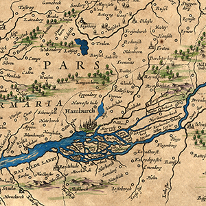
Hondius, Hendrik. Nieuwe caerte waerinne vertoont wordt de gantsche Vaert van Amsterdam over de Watten tot de stadt Hamborch toe. 1634.
- Description: Map of the coastline of the modern Netherlands and Germany, including coastal islands and Hamburg (inset)
- Note: The territory shown is from the bay around Amsterdam in the west to the mouth of the Elba River in the east
- Call Number: G6002 .W3P5 1634 .N5x
Hassia langraviatus. 1644.
- Description: Map of the Landgraviate of Hesse, part of the Holy Roman Empire, in modern Germany
- Call Number: G6370 1644 .H3x
Mercator, Gerardus. Wirtenberg Ducatus. 1658.
- Description: Map of the Duchy of Württemberg, part of the Holy Roman Empire, in modern Germany, with portions of France and Switzerland
- Call Number: G6425 1658 .M4x
Mercator, Gerardus. Transylvania Sibenburgen. 1658.
- Description: Map of Transylvania, then a principality ruled by Hungarian princes as a vassal state of the Ottoman Empire, in modern Romania
- Note: Siebenburgen is the German name for the region
- Call Number: G6882 .T7 1658 .M4x
Hondius, Hendrik. Diocesis Leodiensis accurata Tabula. 1658.
- Description: Map of the Liège, an ecclesiastical state of the Holy Roman Empire, in modern Belgium
- Call Number: G6013 .L4 1658 .H6x
Gigas, Johann Michael. Osnabrugensis episcopatus. 1658.
- Description: Map of the Diocese of Osnabrück, part of the Holy Roman Empire, in modern Germany
- Note: The territory shown is roughly bounded by Meppen in the northwest, the Dümmer See in the northeast, Borgholzhausen in the southeast, and Rheine in the northwest
- Call Number: G6322 .O8 1658 .G5x
Keere, Pieter van der. Erpach comitatus. 1658.
- Description: Map of the Electorate of Erbach, part of the Holy Roman Empire, in modern Germany
- Note: The territory shown is roughly bounded by Aschaffenburg on the Main River in the north, Freudenberg on the Main River in the east, Heidelberg and the Necker River in the south, and the Rhine River in the west
- Call Number: G6393 .E7 1658 .K4x
Clivia ducatus et Ravestein dominium. 1658.
- Description: Map of the Duchy of Cleves, part of the Holy Roman Empire, in modern Germany and the Netherlands; and the Dominion of Rave[n]stein, in the modern Netherlands
- Call Number: G6363 .C55 1658x
Jansson, Jan. Albis, fluvivs, Germaniae celebris, a fontibus ad Ostia, cum fluminibus ab utroque latere in illum, descriptus. 1658.
- Description: Map of the Elbe River, from the North Sea near Hamburg in modern Germany to Prague in the modern Czech Republic
- Note: It is displayed in two plates, one on top of the other, and is oriented according to the course of the river rather than with north at the top.
- Call Number: G6032 .E6 1658 .A5x
Jansson, Jan. Nobilis fluvius Albis: maximâ curâ, ex variis, famosique Autoribus collectus, et in lucem editus. 1658.
- Description: Map of the Elbe River through modern Germany, from the North Sea through Hamburg, then as far south as Geesthacht and Marschacht
- Call Number: G6032 .E6 1658 .J3x
Sanson, Guillaume, and Vincenzo Coronelli. Le Cours du Danvbe depuis sa Source iusquʾa ses Embouchures. 1696.
- Description: Map of the course of the Danube River
- Note: It begins in modern Germany and passes through or between modern Austria, Slovakia, Hungary, Croati, Serbia, Romania, Bulgaria, Moldova, and Ukraine before emptying into the Black Sea
- Call Number: G6032 .D3 1696 .S3x
Senex, John. The Spanish Netherlands commonly called Flanders. 1719.
- Description: Map of the Spanish Netherlands and adjacent territory, including all of modern Belgium and Luxembourg, and parts of modern France, Germany, and the Netherlands
- Note: The territory shown is roughly bounded by the modern cities of Breda, Netherlands, in the north; Cologne, Germany, in the east; and Reims and Calais, France, in the south and west
- Call Number: G5833 .N6 1719 .S4x
Senex, John, and S. Parker (engraver). A new map of the city of Amsterdam. 1720.
- Description: Map of Amsterdam, Dutch Republic (modern Netherlands), with 288 streets numbered and named
- Note: It orients with north toward the bottom right (see compass on map)
- Call Number: G6004 .A5 1720 .P37x
Senex, John. Switzerland and the country of the Grisons: wherein is described the XIII Switz Cantons with their Allies &c. 1721.
- Description: Map of Switzerland showing the 13 cantons of the Old Swiss Confederacy, with portions of modern France, Germany, Liechtenstein, Austria, and Italy
- Call Number: G6040 1721 .S4x
Senex, John. The Empire of Germany: divided into its general and perticular parts. 1721.
- Description: Map of the German states, part of the Holy Roman Empire, with portions of the Spanish Netherlands, France, Switzerland, Austria, Hungary, Poland, and Prussia
- Call Number: G6080 1721 .S4x
Senex, John. A map of Hungary and countries adjacent. 1721.
- Description: Map of the Kingdom of Hungary, which includes modern Slovakia and parts of modern Croatia, Serbia, and Romania, with portions of adjacent territories
- Call Number: G6500 1721 .S4x
Southern
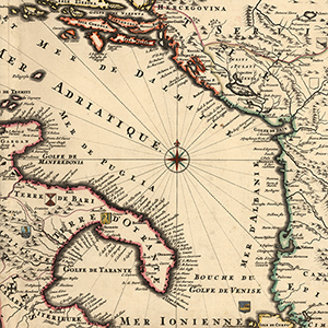
Territorii Romani descrip.: Fori Julii, Vvlgo Frivli Typus. 1600s.
- Description: Left: Map of the ancient Roman regions of Etruria, Umbria, and Latium, with borders roughly at the modern Italian regions of Tuscany, Umbria, and Lazio; Right: Map of the ancient Roman region of Venetia and Istria, in modern Italy and Slovenia
- Note: Left: Map orients with north on the left
- Call Number: G6710 1600z .T4x
Jansson, Jan. Territorium Tridentinum. 1658.
- Description: Map of the Bishopric of Trent (ecclesiastical state) and southern County of Tyrol (imperial estate), part of the Holy Roman Empire, roughly analogous to the autonomous region of Trentino-Alto Adige in modern Italy
- Note: The territory shown is roughly bounded by the Adige and Eisack Rivers in the north, the Piave River in the east, Lago di Garda in the south, and the Oglio River in the west
- Call Number: G6713 .T7 1658 .J3x
Sanson, Nicolas. Le Golfe de Venise: avec ses principaux Caps, Promontoires, & Ports de Mer. 1696.
- Description: Map of the territory around the Adriatic Sea (or Gulf of Venice), then territory belonging to the Republic of Venice or the Ottoman Empire, which includes parts of modern Italy, Slovenia, Croatia, Bosnia and Herzegovina, Montenegro, Albania, and Greece (island of Corfu),
- Call Number: G5672 .A37 1696 .S2x
Senex, John. Italy: distinguished according to the extent of all the states, kingdomes, republicks, dukedoms, principalities &c. that do at present divide it. 1719.
- Description: Map of the Italian states, which includes the Apennine Peninsula, the coast of modern Croatia, and the islands of Sardinia, Sicily, and Corsica
- Call Number: G6710 1719 .S4x
Senex, John. A map of Greece with part of Anatolia. 1720.
- Description: Map of Greece, a portion of Anatolia (then part of the Ottoman Empire) as far east as the island of Rhodes and the city of Constantinople, and a portion of the Balkan Peninsula
- Note: The island of Crete is featured at the bottom of the map as Candia, its name during rule by the Venetian Republic and by the Ottoman Empire
- Call Number: G6810 1720 .S4x
Senex, John (engraver), and John Harris. A New map of Savoy and Piedmont: from the latest observations. 1721.
- Description: Map of the Duchy of Savoy and the Piedmont region, then part of the Kingdom of Sardinia, regions of modern France and Italy, respectively, including insets of Turin (modern Italy) and Verrue (a city that no longer exists, on the Po River between Turin and Vercelli in modern Italy)
- Call Number: G5723 .S2 1721 .S4x
Senex, John. A new map of Rome shewing its antient and present scituation. 1721.
- Description: Map of Rome, capital of the Papal States (modern Rome and Vatican City), with 196 churches or other religious buildings numbered and named
- Note: It also features four inset illustrations of points of historical interest: Ruins of the Amphitheater of Vespasian (Colosseum), St Peters Church and Ye Popes Pallace (St. Peter’s Basillca and the Apostolic Palace), the Sepulcher of Caijus Cestus (Pyramid of Cestius), and Trajans Pillar (Trajan’s Column)
- Call Number: G6714 .R7 1721 .S4x
Senex, John. A new map of Sicily. 1721.
- Description: Map of the Kingdom of Sicily
- Call Number: G6760 1721 .S4x
Eastern
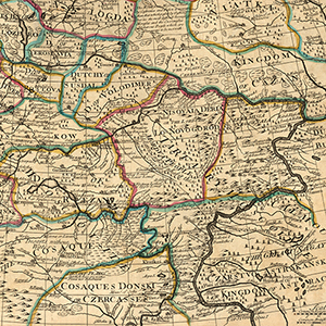
Massa, Isaac Abrahamszoon. Novissima Russiae tabula. 1658.
- Description: Map of Russia, including Fenno-Scandinavia and eastern Europe, as far south and east as the Black Sea and Caspian Sea
- Call Number: G7000 1658 .M37x
Senex, John. Poland and other countries belonging to that crowne: according to the newest observation,. 1719.
- Description: Map of Poland
- Note: At that time the country extended only as far as modern Posnan, Poland, in the west but included all of modern Lithuania, Latvia, Estonia, and Belarus, as well as the western part of modern Ukraine
- Call Number: G6520 1719 .S4x
Senex, John. Moscovey in Europe: from the latest observations. 1721.
- Description: Map of western Russia (Moscovy), including the Lapland region of Fennoscandia, then divided between Denmark-Norway (modern Norway), Sweden (modern Finland), and Russia
- Note: The territory shown ranges from the modern Baltic states (Lithuania, Latvia, Estonia) in the west to Astrakhan (a modern Russian province) in the east
- Call Number: G7001 .S4 1721 .S4x
New World
Overview
The Americas were populated with a diverse array of native peoples in the centuries before the arrival of Europeans in the late 15th and early 16th centuries — before, indeed, they were thought of as a “new world, a unified place called the Americas. However, as these outsiders were the creators of the modern maps being discussed here, in this context our interest is in seeing these territories primarily as colonial and post-colonial possessions.
Maps of the New World show the spread of European colonial interests in the eastern hemisphere, including major players like Spain, Great Britain, Portugal, France, and the Netherlands.
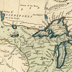
North America was extensively colonized by Great Britain, France, and Spain.
- Britain held much of the east coast of North America, from Georgia in the south to Newfoundland in the north, and the Hudson Bay Company held much of Canada west of the St. Lawrence Valley as Rupert’s Land. The earliest colonies were Roanoke (1580s) and Jamestown (1600s). The last British possession was Canada, which gained it independence in 1867.
- Spain held much of North America west of the Mississippi, a territory stretching from southern Mexico to Alaska called the Viceroyalty of New Spain (1521-1821), as well as Florida. Spanish Louisiana, the area that would later become the Louisiana Purchase, was ceded to the French in 1800. Mexico gained its independence in 1821, and it split Las Californias with Spain, Alta California being U.S. territory west of the Louisiana Purchase and Baja California being a province of Mexico.
- France for a time held a stretch of North America from the Gulf coast to the Hudson Bay. Called New France, its provinces were Canada, which encompassed modern Quebec and Ontario but stretched as far west as modern Saskatchewan; and French Louisiana (La Louisiane française), which consisted of Upper Louisiana (la Haute-Louisiane) and Lower Louisiana (la Basse-Louisiane). It ceded Canada to Britain in the 18th century and most of Louisiana to the United States in 1803.
Central America — modern day Belize, Costa Rica, El Salvador, Guatemala, Honduras, Nicaragua, and Panama — was largely colonized by Spain, with the exception of Belize, which was once known as British Honduras.
Even after the heyday of colonization, many European powers had and still have a foothold in the region by way of Caribbean and Atlantic possessions, an area long referred to as the West Indies. While each of these territories and countries has its own unique culture and place in the world, finding and understanding maps about these areas is only possible if one knows the colonial powers involved — those who made the maps and whose colonization still determines much about local place names. Islands in bold still belong to the European power with which they’re listed.
- The British West Indies included territories in the Lucayan Archipelago: the Bahamas and the Turks and Caicos Islands; islands in the Greater Antilles: the Cayman Islands and Jamaica; and islands in the Lesser Antilles: the British Virgin Islands (once Las Vírgenes), Anguilla, Antigua and Barbuda, Saint Kitts (once San Cristóbal, alternatively Saint Christopher) and Nevis (once Nuestra Señora de las Nieves), Dominica, Saint Lucia, Saint Vincent and the Grenadines, Grenada, Trinidad and Tobago, and Barbados.
- The French West Indies, not including territories only held by France briefly, included Haiti (then Saint-Domingue) and territories in the Lesser Antilles: Guadeloupe, Martinique, Saint Martin, and Saint Barthélemy (once San Bartolomeo, alternatively Saint Barts).
- The Spanish West Indies included territories in the Greater Antilles: Cuba, the Dominican Republic (then Santo Domingo), and Puerto Rico (once San Juan Bautista).
- The Dutch West Indies included territories in the Lesser Antilles: Sint Maarten, Aruba, Bonaire, and Curaçao.
- The Danish West Indies included what is now the U.S. Virgin Islands, in the Lesser Antilles.
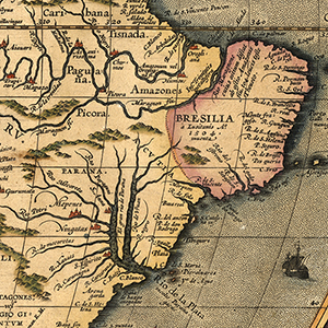
South America was colonized heavily by the Spanish and Portuguese, in addition to other powers. Much of the continent was independent from Europe by the 1830s.
- Brazil was first colonized by the Portuguese in the early 16th century. At first, it only encompassed the far eastern tip of the continent, having gained the territory in the 1494 Treaty of Tordesillas, which divided Castilian (Spanish) possessions from Portuguese. From 1630 to 1654, the Dutch held part of northern Brazil as New Holland. In the early 18th century, the Portuguese expanded their territory, and in 1775 its three large colonies were united into one under the name Brazil.
- The Viceroyalty of Peru (1542-1824), a Spanish possession, once covered much of South America. By 1776, it had been largely carved up and given to other administrative units or lost territory to Portuguese Brazil; it was confined to the north west and far west coast, modern Peru and Chile, with portions of adjacent countries.
- The Viceroyalty of New Granada (1717), a Spanish possession in the north of the continent, once encompassed modern Colombia, Ecuador, Panama, and Venezuela.
- The Viceroyalty of the Río de la Plata (1776-1814), a Spanish possession in the south and east of the continent, encompassed modern Argentina, Bolivia, Paraguay, and Uruguay.
List
Presented chronologically by region.
Western Hemisphere
Ortelius, Abraham. Americae sive novi orbis nova descriptio. 1570.
- Call Number: G3290 1570 O7x
Ortelius, Abraham. La Florida; Pervviae avriferae regionis typis; Gvastecan Reg. 1574.
- Call Number: G3290 1574 .O7 F5x
Ortelius, Abraham. Americae sive novi orbis, nova descriptio. 1587.
- Call Number: G3290 1587 O7x
Mercator, Michael. America siue India Nova ad magnae Gerardi Mercatoris aut Vniversalis imitationem in compendium redacta. 1595.
- Call Number: G3290 1595 .M47x
Hondius, Jodocus. America. 1609? 1622?
- Call Number: G3290 1609 .H65 1622x
Speed, John. America with those known parts in that unknowne worlde both people and manner of buildings. 1626.
- Call Number: G3290 1626 .S6x
Blaeu, Willem Janszoon, and Joan Blaeu. Americae nova tabula. 1635.
- Call Number: G3290 1635 .B5x
Blaeu, Willem Janszoon, and Joan Blaeu. Insvlae Americanae in Oceano Septentrionali cum terris adiacentibus. 1640?
- Call Number: G3290 1640 .B5x
Merian, Matthaeus. America noviter delineata. 1645/1646?
- Call Number: G3290 1646 .M47x
Jansson, Jan. Insulae Americanae in Oceano Septentrionali, cum terris adiacentibus. 1650.
- Call Number: G3290 1650 .J365x
Jansson, Jan. America noviter delineata. 1650.
- Call Number: G3290 1650 .J36x
Wit, Frederik de. Novissima et accuratissima totius Americae descriptio. 1670?
- Call Number: G3290 1670 .W57x
Bertius, Petrus. Carte de L’Amerique: corrigeé, et augmenteé. 1675.
- Call Number: G3290 1675 .B47x
Allard, Carel. Recentissima novi orbis, sive Americae Septentrionalis et Meridionalis tabula. 1680.
- Call Number: G3290 1680 .A44x
Coronelli, Vincenzo. Mare del Nord. 1680?
- Call Number: G3290 1680 .C6x
Morden, Robert, and William Berry. To Captain John Wood this map of the world drawn according to Mercators projection humbly dedicated by Robt. Morden & Willm. Berry. 1688.
- Call Number: G3290 1688 .M67x
Fer, Nicolas de. L’Amérique Meridionale et Septentrionale. 1717.
- Call Number: G3290 1717 F47x
Senex, John. A new map of America from the latest observations. 1721.
- Call Number: G3290 1721 .S46x c.2
Le Rouge. Canada et Louisiane, par le Sr. le Rouge ingénieur géographe du Roy. 1755.
- Call Number: G3290 1755 .L47x
North America
Jode, Cornelis de. Americae pars Borealis, Florida, Baccalaos, Canada, Corterealis. 1593.
- Call Number: G3300 1593 .J6x
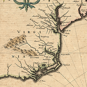
Mercator, Gerardus. Virginiae item et Floridae Americœ Provinciarum, nova descriptio. 1597.
- Call Number: G3870 1597 .M4x
Hondius, Jodocus, and Gerardus Mercator. Cuba Insula; Hispaniola Insula. 1606?
- Call Number: G4900 1606 .M4x
Hondius, Henrick. Mappa Aestivarum Insularum: alias Bermudas dictarum, ad Ostia Mexicani aestuary¨ jacentium in latitudine graduum 32 minutorum 25. 1621.
- Call Number: G9120 1621 .H66x
Visscher, Nicolaes. Insulœ Americanae in Oceano Septentrionali ac Regiones Adiacentes: C. de May ufque ad Lineam Aequinoctialem. 1633.
- Call Number: G3300 1633 .V5x
Jansson, Jan. America Septentrionalis. 1647.
- Call Number: G3300 1647 .J3x
Jansson, Jan. Nova Anglia, Novum Belgium, et Virginia. 1650s.
- Call Number: G3720 1650z .J3x
Sanson, Nicolas. La Floride par N. Sanson, geog. ordre du Roÿ. 1667.
- Call Number: G3930 1667 .S26x
Smith, John. Nova Virginiae tabula. 1671.
- Call Number: G3880 1608 .S5 1671x
Speed, John. A map of Virginia and Maryland. 1676.
- Call Number: G3880 1676 .S7x
Visscher, Nicolaes. Novi Belgii novaeque Angliae nec non partic Virginiae tabula multis in locis emendata. 1682?
- Call Number: G3300 1682 .V57x 1900z
Morden, Robert, and William Berry. New map of the English Plantations in America both Continent and Islands shewing their true situation and distance from England or one with another. 1690.
- Call Number: G3300 1690 .M6x
Sanson, Guillaume. L’Amerique Septentrionale: dresée sur les observations de Mrs. de L’Academie Royale des Sciences & quelque’s autres, & sur les Memoires les plus recens. 1695.
- Call Number: G3300 1695 .S3x
Fer, Nicolas de. Les Costes aus environs de la Riviere de Misisipi: Decoruvertes par Mr. de la Salle en 1683 et reconnues par Mr. le Chevallier d’ Iberville en 1698 et 1699. 1702.
- Call Number: G4042 .M5 1702 .F4x
- Call Number: G3300 1690z .S3x
Homann, Johann Baptist . Amplissimae regionis Mississipi, seu Provinciae Ludovicianae: â R. P. Ludovico Hennepin, Francisc. miss in America Septentrionali, anno 1687. 1717.
- Call Number: G4040 1717 .H6x c.2
Delisle, Guillaume, Francois Le Maire, and Cóvens et Mortier (firm). Carte de la Louisiane et du cours de Mississipi. 1718.
- Call Number: G4042 .M5 1718 .L5x
A map of Carolina, Florida and the Bahama Islands with the adjacent parts. 1730.
- Call Number: G3870 1730 .M36x
Delisle, Guillaume de. Novissima tabula regionis Lvdoviciana gallice dictae La Lovgsiane iam olim quidem sub Canadae et Floridae nomine in America Septentrionali. 1730?
- Call Number: G3300 1730 .L57 N6x
Homann Erben (Firm). Dominia Anglorum in America Septentrionali. 1737.
- Call Number: G3300 1737 .H65x
Albrizzi, Giambattista. Carta Geografica Della Florida Nell America Settentrionale, 1740. 1740.
- Call Number: G3860 1750 .L5
Carte de la Nouvelle France: ou se voit le cours des Grandes Rivieres de S. Laurens & de Mississipi, aujour d’hui S. Louïs, aux environs des-quelles se trouvent Etats, Païs, Nations, Peuples &c. de la Floride, de la Louïsiane, de la Virginie, de la Marie-lande, de la Pensilvanie, du Nouveau Jersay, de la Nouvelle Yorck, de la Nouv. Angleterre, de l’Acadie, du Canada, des Esquimaux, des Hurons, des Iroquois, des Ilinois &c., et de la Grande Ile de Terre Neuve. 1740?
- Call Number: G3300 1740 .C37x
Bellin, Jacques Nicolas. Partie de la coste de la Louisiane et de la Floride: depuis le Mississippi jus qua St. marc d’Apalache. 1744.
- Call Number: G4012.C6 1744 .B4
Bellin, Jacques Nicolas, and Guillaume Dheulland. Plan de la Nouvelle Orleans: sur les manuscrits du dépôt des cartes de la Marine. 1744.
- Call Number: G4014 .N5 1744 B4
Bowen, Emanuel. A new map of Georgia, with part of Carolina, Florida, and Louisiana. 1747.
- Call Number: G3860 1747 .B6x
Kitchin, Thomas. A new map of the Cherokee Nation: with the names of the towns & rivers they are situated on. North latitude from 34 to 36. 1740s.
- Call Number: G3920 1740z .K57x
Bolton, Solomon, Jean Baptiste Bourguignon d’Anville, and Richard William Seale. North America. 1752.
- Call Number: G3300 1752 .B62 N6x
Hinton, John. A Map of the British and French settlements in North America. 1755.
- Call Number: G3321.F2 1755 .H5x
Palairet, Jean, and Thomas Kitchin. Carte des possessions angloises & françoises du continent de l’Amérique septentrionale. 1756.
- Call Number: G3300 1755 .P35 C3x
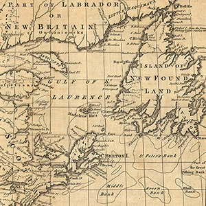
Kitchin, Thomas. A map of New England, and Nova Scotia: with part of New York, Canada, and New Britain & the adjacent islands of New Found Land, Cape Breton &c. 1758.
- Call Number: G3300 1758 .K57x
Cóvens et Mortier (firm). Carte de la Louisiane, Maryland, Virginie, Caroline, Georgie, avec une partie de la Floride. 1758.
- Call Number: G3709.3 1758 .C68x
Homann, Johann Baptist. Nova Anglia. Septentrionali Americae implantata Anglorumque coloniis florentissima geographice exhibita â Ioh. 1759? .
- Call Number: G3710 1759 .H66x
Gibson, J. A map of the new governments, of East & West Florida. 1763.
- Call Number: G3930 1763 .G5x
London Magazine. A New and accurate map of East and West Florida. 1763.
- Call Number: G3930 1763 .N4x
Jefferys, Thomas. Pais cedeś, sheet IId, containing the Peninsula & Gulf of Florida, with the Bahama Islands. 1768.
- Call Number: G3930 1768 .J44x Sheet 2
Jefferys, Thomas. East Florida, from surveys made since the last peace, adapted to Dr. Stork’s History of that country. 1769.
- Call Number: G3930 1769 .J44x
Lotter, Tobias Conradus. Mappa Geographica Regionen Mexicanam et Floridam Terrague adjacentes: ut et Anteriores Americae Insulas, Cursus itidem et reditus Navigantium versus flumen Missisipi et alias Colonias of ocidos ponens. 1760s.
- Call Number: G3300 1760z .L67 M3x
Bowen, Emanuel. An accurate map of North America describing and distinguishing the British and Spanish dominions on this great continent: according to the definitive treaty concluded at Paris 10th February 1763. Also all the West India islands […]. 1772.
- Call Number: G3300 1763 .B6 1772x
Delisle, Guillaume, and Tobias Conrad Lotter. America Septentrionalis: concinnati juxta observationes Dnn: Academiae Regalis Scientiarum et nonnullorum aliorum, et juxta annotationes recentissimum. 1772.
- Call Number: G3300 1772 .L57 A5x
Central America & West Indies
- Call Number: G3932 .W4 1772 G4x
- Call Number: G3860 1781 .B39x
Moll, Herman. The Scots settlement in America called New Caledonia, A.D. 1699. 1699? 1732?
- Call Number: G4872 .C25 1699 .M6x
Senex, John. A new map of the English Empire in the Ocean of America or West Indies. 1712.
- Call Number: G4900 1712 .H3x
Bodenehr, Gabriel. Neuer plan der stadt ū hafens Havana. 1720?
- Call Number: G4924 .H3 1720 .B6x
- Call Number: G4870 1721 .D7x
Moll, Herman. Nieuwe kaart van het eyland Barbados behelzende alle deszelfs Dorpen en voors naamste Plantasien, mitsgaders Schanzen, Linien Batteryen en Wegen. 1721.
- Call Number: G5140.B2 1721 M66x
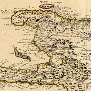
Delisle, Guillaume. Carte de l’Isle de Saint Domingue. 1722.
- Call Number: G4930 1722 .L57x
Moll, Herman. The island of Jamaica, divided into its principal parts, with the roads, etc. 1732.
- Call Number: G4960 1732 .M6x
Moll, Herman. The island of St. Christophers alias St. Kitts. 1732.
- Call Number: G5040 1732 .M6x
Moll, Herman. The island of Antego. 1732.
- Call Number: G5050 1732 .M6x
- Call Number: G4900 1738 .B6x
Bellin, Jacques Nicolas. Carte de l’isle de la Grenade: pour servir à l’Histoire générale des voyages. 1758?
- Call Number: G5130 1758 .B4x
Kitchin, Thomas. An accurate map of the Caribby Islands, with the Crowns, &c. to which they severally belong. 1759.
- Call Number: G4900 1759 .K5x
Jefferys, Thomas. Bequia or Becouya, the northermost of the Granadilles, surveyed in 1763. 1775.
- Call Number: G5122 .B4 1763 .J41 1775x
Bowen, Thomas. A map of the Island of Dominica taken from an actual survey: also part of Martinico and Guadalupe showing their true bearing and distance from each other. 1778.
- Call Number: G5100 1778 .B6x
South America
Moll, Herman. A Map of the West-Indies or the Islands of America in the North Sea; with ye adjacent Countries; explaining what belongs to Spain, England, France, Holland &c. 1715.
- Call Number: Oversize G4390 1715 .M6x
Moll, Herman. A map of Chili, Patagonia, La Plata and ye south part of Brasil. 1732.
- Call Number: G5200 1732 .M6x
Moll, Herman. The island of Bermudos, divided into its tribes, with the castles, forts, etc. 1732?
- Call Number: G9120 1732 .M6x
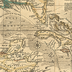
Golfe du Mexique: assujetti aux observations astronomiques. 1770?
- Call Number: G9112.M48 1770 .P3
U.S. & the Americas
Overview
The thirteen colonies declared independence from Great Britain in 1776, entered into confederation in 1781 with the ratification of the Articles of Confederation, were recognized as independent in 1783 with the Treaty of Paris, and entered into union with the ratification of the Constitution in 1788.
Maps of the early U.S. show it to be one of many powers on the North American continent. The British held territories to the north, in what is now Canada, and the Spanish and French held much of the west.
- Territory ceded by Great Britain in 1783 included the eventual states of Vermont, Kentucky, Tennessee, Mississippi, Alabama, and all those formerly part of the Northwest Territory: Ohio, Indiana, Illinois, Michigan, Wisconsin, and portions of Minnesota.
- Territory ceded by France in the 1803 Louisiana Purchase included the eventual states of Arkansas, Oklahoma, Missouri, Kansas, Iowa, Nebraska, and South Dakota; and portions of Louisiana (Orleans Territory), Texas, New Mexico, Colorado, Wyoming, Montana, North Dakota, and Minnesota. (In an 1818 treaty, Britain ceded the remainder of territorial Minnesota and North Dakota, an area around the Red River Basin).
- Territory ceded by Spain in the 1819 Adams–Onís Treaty included East Florida, what is now the state of Florida; West Florida, with parts of modern Louisiana (east of the Mississippi River), Mississippi, and Alabama; and the remainder of modern Louisiana (Neutral Ground between the old Orleans Territory and Spanish Texas).
List
Presented chronologically.
Denis, Louis. Carte du Golphe Du Mexique. 1780.
- Call Number: G4390 1780 .D4
Zatta, Antonio. Luigiana Inglese: Colla parte occidentale della Florida, della Giorgia, e Carolina Meridionale [e] parte Orientale della Florida, della Giorgia e Carolina Meridonale. 1788.
- Call Number: G3870 1788 .Z37x
Bowles, Carington. Bowles’s New one-sheet map of the United States of America: with the territories belonging to Great Britain and Spain. 1794.
- Call Number: G3701 .F2 1794 .B6x
Robert Laurie and James Whittle (firm). A new and general map of the Southern dominions belonging to the United States of America, viz North Carolina, South Carolina, and Georgia: with the bordering indian countries, and the Spanish possessions of Louisiana and Florida. 1794.
- Call Number: G3860 1794 .R62x
Jeffreys, Thomas. The Coast of West Florida and Louisiana, 1794. 1794.
- Call Number: G3932.C6 1794 .J4
- Call Number: G3870 1790z .P87x
Barker, W. The United States of America. 1801.
- Call Number: G3700 1801 .B37x
James, Wallis, and S.A. Oddy (firm). United States of America. 1811.
- Call Number: G3701 .S3 1811 .J3x
Carey, Matthew. Map of the United States of America. 1814.
- Call Number: G3700 1814 .C3x
Lapie, Pierre. Carte des États-Unis. 1814.
- Call Number: G3700 1814 .L36x
Jackson, Andrew. Sketch of an attack made by Majr. Genl. Jackson on a Division of the British Army commanded by Majr. Genl. Kean on the evening of the 23 Dec. 1814. 1814.
- Call Number: G4042 .M5 1814 S4x
- Call Number: G4014 .W5 1815 P6x
Lafon, Bartholomew. Plan of the city and environs of New Orleans. 1816.
- Call Number: G4014 .N5 1816 .L33x
Lucas, Fielding. United States. 1817.
- Call Number: G3700 1817 .L8x
John Thomas and Company (firm). Southern provinces of the United States. 1817.
- Call Number: G3860 1817 .T46x
Tanessee, J. Plan of the city and suburbs of New Orleans: from an actual survey made in 1815. 1817.
- Call Number: G4014 .N5 1817 .T3x
Darby, William. A Map of the United States including Louisiana. 1818.
- Call Number: G3700 1818 .D3x
Collot, Victor George Henri. Chart of the Sources of the Mobile and the River Yazoo Including a part of the Course of the Mississippi from the River Margot to the Natches. (1826). 1826.
- Call Number: G3972.M64 1826 .T3x
Union Congressional Committee. What the administration has done: map showing the progress of the national armies during the years 1861, 1862, 1863 and 1864. 1864.
- Call Number: Oversize E458.4 .W43 1864
Russell, John. Map of the Southern provinces of the United States. 1800s.
- Call Number: G3860 1800z .R8x
Melish, John. Map of the country belonging to the Cherokee and Creek Indians: from the original drawing in the War Department. 1800s.
- Call Number: G3865 .P2 1800x M3
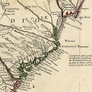
Alabama
Overview
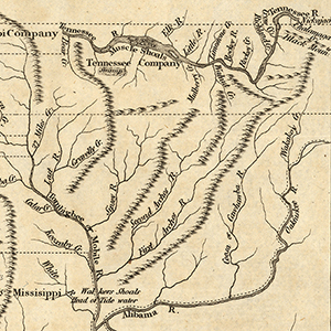
The territory we now call Alabama has long appeared on maps of North America. To trace those maps, it’s helpful to know who possessed the territory — or, more accurately, the various parts of it.
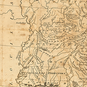
- The lower third of the future state (south of modern Montgomery but not including the Gulf coast) was sparsely settled until the late 18th century. It formed part of the new Mississippi Territory in 1798.
- The upper portion of state, known as the Yazoo lands, was part of British Province of Georgia and subsequently the State of Georgia (1767-1804). It joined the Mississippi Territory in 1804.
- Coastal Alabama (modern Baldwin and Mobile counties) was part of French Lower Louisiana (1702-1763), British West Florida (1763-1783), Spanish West Florida (1783-1810), and the short-lived independent Republic of West Florida (1810-1812). Because of the Louisiana Purchase, it was annexed to the Mississippi Territory in 1812; however, control of that area was disputed with Spain until 1819, when all of Florida was ceded to the U.S. (taking effect in 1821).
- Alabama Territory split from the new state of Mississippi in 1817.
- Alabama was admitted to statehood in 1819.
Our early Alabama maps cover much of this territorial background, and they also highlight important aspects of the state’s history, including the Native American tribes native to the area and subsequent wars with some of these tribes. They also show the political, administrative, and economic changes that came to the early state. Several cities served as the territorial or state capital, their locations showing a tug of war between regional interests: St. Stephens (1817-1819) was in the southwest, about 60 miles north of Mobile; Huntsville (1819-1820) is in the north, about 20 miles south of the border with Tennessee; and subsequent capitals were nearer the center: Cahaba (1820-1825), near Selma; Tuscaloosa (1826-1846); and Montgomery (1846-present).
List
Presented chronologically.
A correct map of the Georgia Western territory. 1798.
- Call Number: G3920 1798 .P6x
Peel & Sannoner (firm), and John Ralph Gardiner. Map of the late surveys in the Northern district of the Alabama territory. 1820s..
- Call Number: G3970 1810z .P4x
Fenner, Sears and Company (firm). Map of the states of Alabama and Georgia. 1831.
- Call Number: G3970 1831 .M3x
Lucas, Fielding. Alabama. 1800s.
- Call Number: G3970 1800z .L8x
Sarony & Major. Map of the war in South Alabama in 1813 and 1814. 1800s.
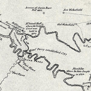
- Call Number: G3971.S43 1800z .M3x
Bache, Alexander Dallas. Coast Survey of Mobile Bay: A. D. Bache, Superintendent of the Coast Survey of the United States, Entrance to Mobile Bay. 1851.
- Call Number: G3972 .M5 1851 .U5
A sketch of the Battle of Talladega. 1817.
- Call Number: G3973 .T3 1817 S6x
The Battle of the Horse Shoe, 27th March 1814. 1814.
- Call Number: G3973 .T4 1814 B2x
Lewis, Samuel. Mississippi territory. 1804.
- Call Number: G3980 1804 .L4x
Carey, Matthew. Mississippi territory. 1813.
- Call Number: G3980 1813 .C3x
Carey, Matthew. Mississippi Territory. 1814.
- Call Number: G3980 1814 .C3x
d’Anville, Jean Baptiste Bourguignon. Map of Louisiana, from d’Anville’s atlas. 1788.
- Call Number: G4010 1788 .A58x